
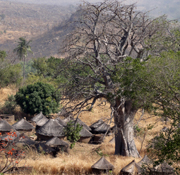
Taneka Beri, a village in Atakora, Benin
The International Carlo Scarpa Prize for Gardens
XXII Annual Award, 2011
The Jury of the International Carlo Scarpa Prize for Gardens has decided unanimously to dedicate the 2011 cultural campaign, the twenty-second since the Prize was instituted, to a village in the region of Atakora in Benin. The name it is known by oscillates between the historical Seseirhà, “superimposed houses”, and the more recent Taneka Beri, “great taneka”.
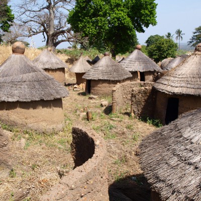
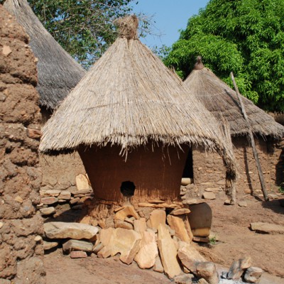
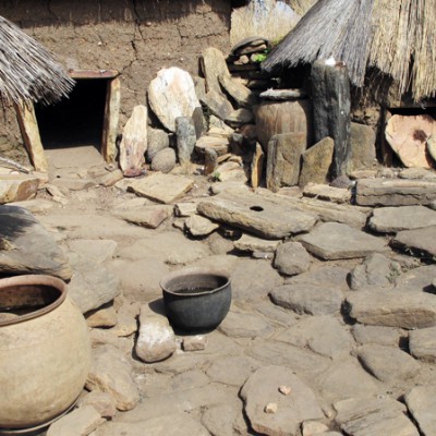
It consists of a thousand or so small constructions, used as rooms, barns, and for other purposes; most have a circular plan and a conical roof, with a diameter varying between two and three metres; they stand in small groups of ten or twelve around a multi-functional open space. Each of these groups comprises a residential unit in which lives an extended family belonging to the Tangba people, “great warriors”, who are also known as the Taneka people, “those of stones”.
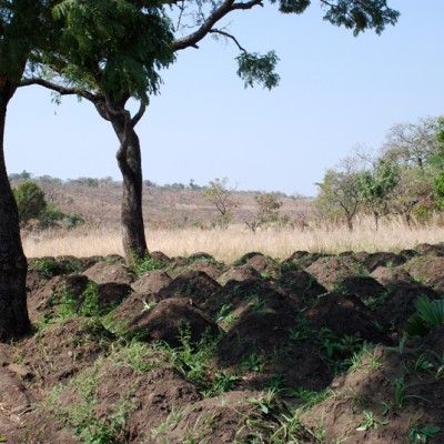
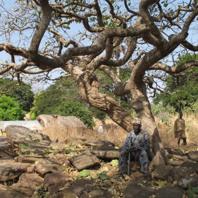
The residential units in turn are variously grouped to form the four recognisable parts into which the village is divided. In colonial times they were called quartiers, but they are in fact separate settlements (perhó) each with its own name, Satyekà, Tyaklerò, Galorhà, Pendolou; they are significantly independent of each other, to the extent that they are governed by different political authorities (sawa) and observe distinct rituals involving sages, hierophants and specialists. And it is the sacred places, the altars, burial grounds and spaces for ritual dances, together with the omnipresent stones and the huge trees, that mark out the land occupied by the village.
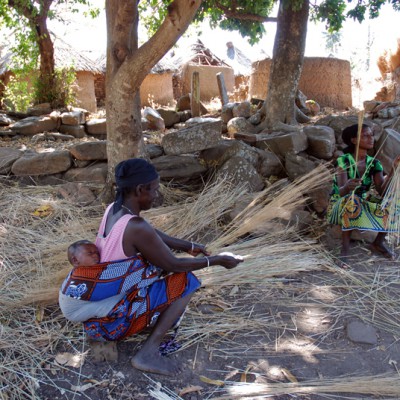
Of the approximately thirty thousand individuals that are estimated to make up the Tangba (Taneka) people, the community that lives permanently at Taneka Beri accounts for no more than three hundred, but the official statistics show a population of over ninety thousand; this is because all those who work and are domiciled elsewhere, in cities or the countryside, state that they are resident in the village and in fact return there for all the important collective ceremonies and other occasions. This sense of belonging is the result of a long process which has seen the creation, by pacific means, of a multi-ethnic and pluri-lingual community with a complex organization of interpersonal and intergenerational relationships based on a profound and spontaneous connection with their history and the land they occupy.
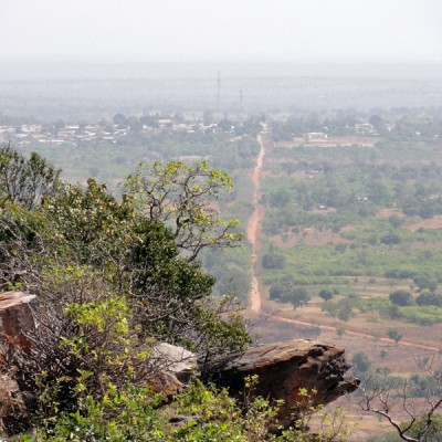
The four units that make up the village are arranged from north to south in sequence along a slightly curved line which is about eight hundred metres long and an average of about two hundred metres wide; but the area considered to be “within” the village is much bigger and has since the XVIII century been bounded by a small wall built to defend it from slave-raiders marauding from the south. The village is part of a cluster of settlements that were intended originally to provide refuge; they lie at a level of approximately six hundred metres a.s.l., in a range of hills that stand out from the surrounding territory. Access from the east is via a gentle, four-kilometre-long rise starting from the municipal centre of Copargo, which is about five hundred metres a.s.l.; punctuating the western approach, from Taneka Koko (Dur), is the steep, north-east/south-west side of one of the southern outcrops of the Atakora massif, a mountain system about five hundred kilometres to the north of the coast of the Gulf of Guinea. Watercourses flow from the Atakora massif north-east towards the River Niger, west towards the Volta basin and southwards into the River Ouémé, which rises between Copargo and Taneka Beri and whose basin comprises much of what is now the territory of the Republic of Benin.
Text taken from the 2011 Carlo Scarpa Prize Statement, edited by the Jury.