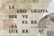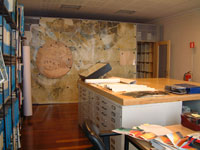
Map library
Born in 1995, besides editing the cataloguing and preservation of the map materials pertaining the study activity of the Fondazione (workshops, prizes, courses, researched and editions), the map library acquires and studies historical and contemporary map documentations related to the territory of the Trevigiano and Veneto, stored in institutes, libraries and archives on a European level.
The map heritage, divided into funds and series mainly consists of contemporary materials, tables drawn up by the Italian geographic military institute, regional technical maps, cadastral maps, layouts, aerial photography, satellite images and orto-photos. Moreover, several examples of historical maps in copy are stored (anastatic editions, photographs and slides), besides materials produced by the Fondazione during its whole research activity.
The documentation includes 7,361 geographic maps, 3,000 regional technical maps, 147 original maps of Treviso and its territory, 447 aerial photographs, 1,600 slides, 529 CDs, DVDs, and 148 roll holder tubes.
The maps are available through the unified electronic catalogue of the library and their duplication is forbidden.
This page has lastly been updated on December 31st, 2021.