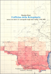
L’officina della Kriegskarte
Anton von Zach e le cartografie degli stati veneti, 1796-1805
by Massimo Rossi
Fondazione Benetton Studi Ricerche-Grafiche V. Bernardi
Treviso-Pieve di Soligo 2007
156 pages
22 illustrations in colour and 3 black and white
cover price 21 euros
ISBN 978-88-902058-3-5
(Memorie, 12)
[The Making of the Kriegskarte. Anton von Zach and mapping of Ducky of Venice, 1796-1805]
The raison d’être of military maps is to help win wars, but at the same time they embody an imago mundi of their historical period. The Kriegskarte of the Duchy of Venice, drawn for the Austrian General Staff between 1792 and 1805, offers striking evidence of the graphic and descriptive skills of European topographers between the end of the XVIII and the beginning of the XIX century.
According to Karl von Clausewitz, the empathetic relationship between a map and its reader can help to generate an interior image, «a sense of locality», of the area covered.
During their Italian campaigns the map-makers of the French and Austrian armies combined science, technical skill and artistic talent to meet this challenge.
Examination of the process of creating a map reveals relations with other cartographic documents, institutions, events and people, all of which influence the construction of a forma mentis, a cultural approach to the perception, description and illustration of the places concerned.
This volume is closely connected to the edition Kriegskarte 1798-1805. Il Ducato di Venezia nella carta di Anton von Zach/Das Herzogtum Venedig auf der Karte Antons von Zach (Treviso-Pieve di Soligo 2005), as a comprehensive exploration of the historical and scientific nature of the creative process. Archival research carried out in France, Austria, the Veneto and Friuli has helped to establish a clearer picture of the functions performed by contemporary cartographic documents and of those who created them.
Massimo Rossi (1959) is an expert in the history of cartography. He graduated from the University of Ferrara in 1986 and won a scholarship to study at the Center for the History of Cartography at the Newberry Library in Chicago in 1989. He has worked as coordinator of the Este Archive of Historic Cartography at the Institute of Renaissance Studies in Ferrara and has been responsible for the cartographic section of the Fondazione Benetton Studi Ricerche Library since 1996.
Contents
Ringraziamenti, 7
Premessa, 9
Tavola delle abbreviazioni, 11
Ingegneri geografi e ufficiali topografi imperiali, 13
Ingegneri geografi francesi, 13
Topografi militari austriaci, 16
La cartografia disponibile dei territori veneti, 17
La ricerca dei materiali cartografici locali, 21
La «Reconnaissance militaire du Pays Vénitien compris entre l’Adige et la Piave», 25
La «Topographisch-geometrische Kriegskarte von dem Herzogthum Venedig», 29
Il titolo, 29
Formato, caratteristiche e quadro sinottico, 32
La scala, 33
Lo schema del rilevamento del Veneziano, 34
Il quadro sinottico, 36
Le copie manoscritte, 41
Lo schema della triangolazione, 41
Il rilievo e la redazione della Kriegskarte: la «Monatliche Correspondenz» e il contributo dell’Osservatorio astronomico di Padova, 41
La misurazione della base padovana, 47
L’Osservatorio astronomico di Padova e il meridiano di riferimento, 49
La misurazione della base di Passariano, 55
Carte francesi e misurazioni austriache, 57
Il lavoro dei “détailleurs”, 58
I rilievi istriani del 1797 e del 1804, 65
La fortuna critica della Kriegskarte in Italia, 66
Descrizioni militari, 67
Il paesaggio dei militari, 69
Topografi viaggiatori, 72
Problemi di nomenclatura, 76
La compilazione delle tabelle, 77
L’«Elenco sommario» del Veneziano, 81
La Kriegskarte negli archivi veneti e friulani, 83
L’avvio delle operazioni di rilevamento: il «Proclama» a stampa e le tracce del passaggio dei topografi negli archivi veneti e friulani, 83
Gli “ufficiali mappisti” in Friuli, 93
Le fasi di realizzazione della Kriegskarte, 98
La Kriegskarte e i trattati di pace, 101
Da Leoben a Presburgo, 101
L’edizione a stampa del «Ducato di Venezia», 107
Note biografiche, 111
Gli ufficiali topografi austriaci, 111
Il generale von Zach, 114
La Kriegskarte e i valori storici della cartografia, 119
Appendice documentale, 129
Lettera di Giuseppe Toaldo a Giacomo Nani, Padova 21 giugno 1777, 129
Proclama del 24 aprile 1798, 129
Editto del 22 maggio 1801, 130
Decreto dell’11 giugno 1801, 131
Decreto del 22 giugno 1801, 131
Circolare del primo agosto 1801, 132
Circolare del 14 agosto 1801, 132
Decreto del 17 settembre 1801, 132
Polizze di pagamento degli ingegneri militari austriaci, settembre-ottobre 1801, 133
Notificazione del 3 novembre 1801, 134
Notificazione del 6 dicembre 1801, 134
Notificazione del 21 dicembre 1801, 135
Circolare del 27 marzo 1802, 135
Circolare del 2 aprile 1802, 135
Decreto del 16 dicembre 1802, 136
Editto del 21 dicembre 1802, 136
Circolare del 3 febbraio 1803, 136
Elenco delle latitudini e longitudini geografiche di alcune località […], marzo 1803, 137
Elenco delle latitudini e longitudini geografiche di alcune località […], giugno 1803, 138
Circolare del 25 settembre 1803, 140
Lettera di Filippo Crivellari, 1803, 140
Osservazioni sull’acquerellare, 1852, 140
Bibliografia citata, 143
Elenco delle illustrazioni, 148
Indice dei nomi e dei luoghi, 149
