
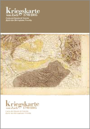
Kriegskarte, 1798-1805
Il Ducato di Venezia nella carta di Anton von Zach / Das Herzogtum Venedig auf der Karte Antons von Zach
[The Duchy of Venice in the Anton von Zach map]
edited by Massimo Rossi
Fondazione Benetton Studi Ricerche-Grafiche V. Bernardi
(in collaboration with Österreichisches Staatsarchiv, Kriegsarchiv, Vienna)
Treviso-Pieve di Soligo 2005
euros 300
ISBN 88-902058-0-6
This scholarly edition of the Anton von Zach map will be published in 2005, to mark the 200th anniversary of its completion in 1805: an invaluable source of information about the configuration and life of an area of about forty thousand square kilometres which corresponds, with partial historical border differences, to the present Italian regions of the Veneto and Friuli.
The Topographisch-geometrische Kriegskarte von dem Herzogthum Venedig (Topographic-geometrical military map of the Duchy of Venice), now conserved in the Kriegsarchiv of Vienna, was produced for the Austrian General Staff
by a group of topographers coordinated by Staff Officer Anton von Zach.
The edition includes all 120 of the sheets at the original scale (1: 28.800 ca.), a transcription of the 922 manuscript military description papers (Militärische Beschreibungen) together with an Italian translation, a German/Italian glossary of about four hundred technical terms and an index of the thousands of place names mentioned.
The work as a whole constitutes an essential source of knowledge about the history and geography of North-East Italy in the troubled transition phase connecting the Republic of Venice to the period of Hapsburg domination.
Five years of research and a further two years of editing have led to a publication on profitable purchase terms which is indispensable in several fields. Scientific and professional spheres have acquired new references for historians and geographers, for cartographers and topographers, for town planners and landscape experts. Institutions at European, national and local levels, especially regions, provinces and municipalities, now have new means of identifying changes and environmental and territorial layering over a period of two centuries.
And the community in general is enriched because the work constitutes documentary evidence of places, symbols and names that now re-emerge as distinctive components of our common heritage in the construction of Europe.
The work comprises:
– 120 topographical sheets and 2 key maps in colour; format 69,5 x 49 cm folded to 34,75 x 24,5 cm;
– the main Volume, approximately 840 pages (in two tomes, closed format 34 x 24 cm), comprising the military descriptions (transcription of the German original with an annotated Italian translation) of the places as they were between 1798 and 1805, a glossary of approximately 400 headwords and analytical indices. The military descriptions (Militärische Beschreibungen), complete with over 80 tables, are preceded by a critical section (Statistical list of the Venetian territory; Note on the transcription; Graphic changes and linguistic interferences; Terminological specifications; General introduction and notes on the context).
– a guide to consultation of the work (approximately 30 pages, format 34,5 x 24,5 cm), arranged under specific headings (Title; General characteristics and geographical coordinates; Scale; Key map; Synoptic table; Manuscript copies; Triangulation key; Stages in the production of the map; Critical judgement in Italy; Biographical note on General von Zach).
The plates, the main volume and the guide are housed together in a linen bound case (closed format 36 x 26 x 15 cm).
Fondazione Benetton Studi Ricerche
Editorial supervisor and art director: Domenico Luciani.
Scientific editor: Massimo Rossi.
Coordinating editor: Patrizia Boschiero.
Apparatus criticus: Massimo Rossi.
Transcription of the German text and translations from German into Italian: Cristina Fossaluzza, Daniela Pace; transcriptions of the French text and translations from French into Italian: Massimo Rossi; linguistic consultants: Hannes Obermair e Sylvie Teulier. Translations from Italian into German: Jesko Kleine.
Officials of the Kriegsarchiv also collaborated, in particular the present Director, Christoph Tepperberg, retired Directors Erich Hillbrand and Rainer Egger, the head of the Karten und Plansammlung department, Robert Rill, and the head of the library, Adolf Gaisbauer.
Grafiche V. Bernardi s.r.l.
Sales director: Alberto Bernardi.
Photographic reproductions: Paolo Mario Belvedere.
Filmsetting, photolithography and printing: Grafiche V. Bernardi s.r.l.
Edition outline
Kriegskarte edition-eng
(pdf format, 1,5 Mb)
Kriegskarte Ausgabe-de
(pdf format, 1,5 Mb)
Sheet example
Sezione/Section XII.12-A4
(pdf format, 2,6 Mb)
Sezione/Section XII.12-A3
(pdf format, 2,6 Mb)