
Atlante Veneto
Per un catalogo del patrimonio cartografico regionale
[Towards a catalogue of historical maps in the region]
edited by Massimo Rossi
Fondazione Benetton Studi Ricerche
Treviso 2019
4 pages, 12 illustrations
ISBN 978-88-8435-191-3
Free pamphlet
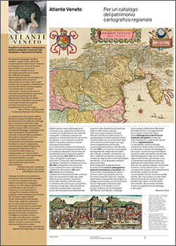
December 2019 saw the publication of Atlante Veneto. Per un catalogo del patrimonio cartografico regionale, edited by Massimo Rossi, a 4-page pamphlet that gives a concise but comprehensive overview of the survey, which started in 2012 and is still ongoing, that will lead to a catalogue of all the historical maps preserved in the libraries and archives of the Veneto.
The publication starts with statements by the directors of the institutions (Fondazione Benetton Studi Ricerche, Veneto Region, Regional Secretariat for the Veneto of the Italian Ministry of Culture and Tourism) that have supported the project over the years. An initial census of the printed maps kept in the 150 relevant institutes in the Veneto was completed in 2017; and in 2019 the survey was extended to include manuscript maps preserved in archives and libraries throughout the Region.
The illustrations offer a clear introduction to the important implications of the project, especially as regards the informed use of historical cartography in public and private town and country planning and in drafting the Regional Landscape Plan.
The Atlante Veneto project includes the organization of training courses for librarians and archivists in appropriate cataloguing procedures for cartographic material, and a later phase will involve the digitizing and on-line storage of cartographic materials relating to the Veneto that are held in archives elsewhere in Italy and abroad.